


Regions (Marzes)
 Armenia has 11 administrative territorial units or “marzes”: Aragatsotn, Ararat, Armavir, Gegharquniq, Lory, Kotayq, Shirak, Syunik, Vayots Dzor, Tavush, and Yerevan.
ARAGATSOTN
Covering 2,753 sq. km, 9% of Armenia’s territory, there are three urban and 111 rural communities in the region. The major towns are Ashtarak (Marz center), Talin, and Aparan. The leading economic sectors are industry and agriculture. The geography and climate are favorable for both crops including grain, potatoes, and perennial grass, and for cattle breeding.
ARARAT
Covering 2,096 sq. km, 7% of Armenia’s territory, there are four urban and 93 rural communities in the region. The major towns are Artashat (Marz center), Ararat, Vedi, and Masis. The economy is specialized in fruit and vegetable growing and wine production.
ARMAVIR
Covering 1,242 sq. km, 4% of Armenia’s territory, there are three urban and 93 rural communities in the region. The major towns are Armavir (Marz center), Metsamor, and Vagharshapat. The leading economic sectors are agriculture and industry. The geography and climate are favorable for crops such as basic grains and vegetables, and cattle breeding. Industrial production is specialized in food products, soft drinks, beverages and building materials. The Armenian Nuclear Power Plant is also located in the marz, producing about 40% of the country’s electricity.
GEGHARKUNIK
Covering 5,348 sq. km, 18% of Armenia’s territory,  there are five urban and 87 rural communities in the region. Lake Sevan, the largest body of fresh water in the Southern Caucasus, is located in Gegharkunik Marz. The major towns are Gavar (Marz center), Sevan, Martuni, and Vardenis. The principal economic sectors are agriculture, particularly grain, potatoes and vegetables; mining of gold, dolomite, basalt, sand, volcanic tuff, and fishing. Gegharkunk it is the main supplier of fresh fish to the country’s population.
LORI
Covering 3,789 sq. km, 13% of Armenia’s territory, there are eight urban and 105 rural communities in the region. The major towns are Vanadzor (Marz center), Spitak, Tashir, and Alaverdi. The leading economic sectors are agriculture and metallurgy. The agriculture industry is founded on grain, potatoes and vegetables, and animal husbandry products.
 KOTAYK
Covering 2,089 sq. km, 7% of Armenia’s territory, there are seven urban and 60 rural communities in the region. The major towns are Hrazdan (Marz center), Abovyan, and Charencavan. The region is rich with mineral waters, found in Bjni and Arzni. Industry is specialized in food and beverage production, non-metal mineral production (glass and cement), metallurgy and metal products (steel and iron casting), and furniture. The region also has three large poultry farms, and two large electricity plants, giving it an strong role in Armenia’s energy sector.
SHIRAK
Covering 2,681 sq. km, 9% of Armenia’s territory, there are three urban and 116 rural communities in the region. The major towns are Gyumri (Marz center), Artik, and Maralik. The territory contains the main railway and automobile highway connecting Armenia with Georgia, and the railway and road networks of  Armenia and Turkey are connected here. The leading economic activities are food and beverage production, and non-metal mineral products such as tufa and pumice of artik.
SYUNIK
Covering 4,506 sq. km, 15% of Armenia’s territory, there are seven urban and 102 rural communities in the region. The major towns are Kapan (Marz center), Goris, Sisian, and Meghri. Leading economic sectors are the mining industry and electricity production. Agriculture is specialized in crops and animal husbandry.
TAVUSH
Covering 2,704 sq. km, 9% of Armenia’s territory, there are fve urban and 57 rural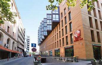 communities in the region. The major towns are Ijevan (Marz center), Tavush, Noyemberyan, and Ayrum. The leading economic sectors are manufacturing and agriculture. Food, wine, mineral waters, stone and wood products are exported to external markets.
VAYOTS DZOR
Covering 2,308 sq. km, 8% of Armenia’s territory, there are three urban and 41 rural communities in the region. The major towns are Eghegnadzor (Marz center), Jermuk, and Vayk. The leading economic sector is agriculture – viniculture, fruit and vegetables. The territory is famous for Jermuk mineral water and the Jermuk resort town.
YEREVAN
Yerevan is located on the edge of the Ararat Valley on both banks of the river Hrazdan, at an altitude of 900-1200 meter above sea level. The climate is acutely continental, with hot and dry summers and relatively severe winters. Yerevan covers 227 sq. km, 1% of Armenia’s territory. It is the capital of Armenia, and the residence of the President of Armenia. The National Assembly, Government, all ministries and main departments, public and other organizations, unions, foundations, commissions, legal bodies, fnancial institutions, offces of international organizations, and diplomatic institutions of Armenia are all situated here. Yerevan is the largest economic and fnancial center of the Republic of Armenia. The main industries are food and alcoholic beverage production, chemicals and metallurgy.


")


